
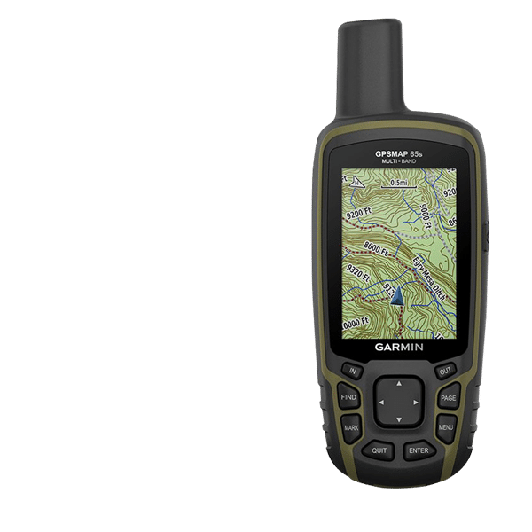
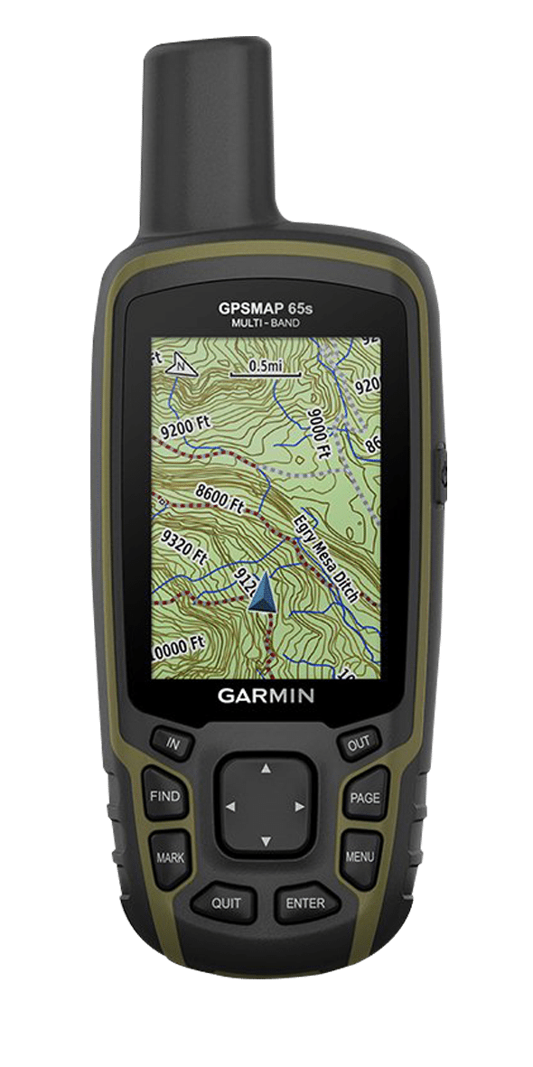
GPS MAP 65s
Multi-band/multi-GNSS handheld with sensors


GPS MAP 65s
Multi-band/multi-GNSS handheld with sensors
FIND YOUR WAY IN THIS BIG, WIDE WORLD
Navigate your next adventure with the GPSMAP 65s handheld navigator series. Whether you’re hiking, cycling, geocaching or climbing, you are free to explore more with proven Garmin handheld navigation in the palm of your hand. And the series now has multi-GNSS support and TopoActive mapping.
Specifications:
- Don’t miss a detail with this large, sunlight-readable colour display.
- Lead the way in challenging locations with multi-band technology and expanded GNSS satellite support.
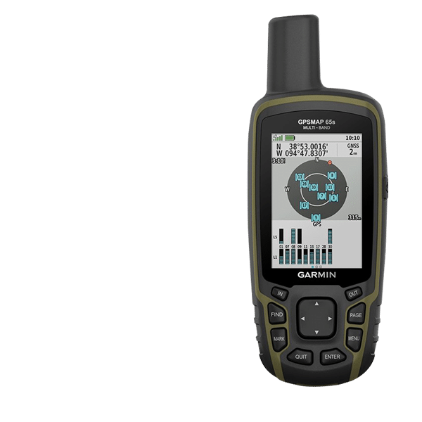
- Know where you’re at with a high-sensitivity receiver with quad helix antenna and multi-GNSS support (GPS, GLONASS and Galileo) and 3-axis compass with barometric altimeter
- Wireless connectivity via BLUETOOTH® technology and ANT+® technology available on GPSMAP 65s model
- Organise your adventure from anywhere with the Garmin Explore™ website and app1.
- Travel with up to 16 hours of battery life in GPS mode.
EXPANDED GNSS SUPPORT
Multi-band technology and expanded GNSS support (GPS, GLONASS, Galileo, QZSS and IRNSS) provide optimal accuracy in steep country, urban canyons and forests with dense trees.
ABC SENSORS
Navigate every trail with ABC sensors, including an altimeter for elevation data, barometer to monitor weather and 3-axis electronic compass.
PRELOADED TOPOACTIVE AFRICA MAPS
Preloaded TopoActive Africa maps provide detailed views of street and off-road networks, waterways, natural features, land use areas, buildings and more.
GEOCACHING
Get automatic cache updates from Geocaching Live, including descriptions, logs and hints.

SMART NOTIFICATIONS
Receive emails, texts and alerts right on your handheld when paired with your compatible device.
GARMIN EXPLORE APP
Plan, review and sync waypoints, routes and tracks by using the Garmin Explore app1 and website. You can even review completed activities while still in the field.
MICROSD™ SLOT
Using your compatible device and microSD memory card, conveniently download TOPO 24K maps and hit the trail, or access HuntView Plus maps to see public land types and boundaries as well as private landowner names and boundaries.
Content courtesy of www.buy.garmin.com
FIND YOUR WAY IN THIS BIG, WIDE WORLD
Navigate your next adventure with the GPSMAP 64x handheld navigator series. Whether you’re hiking, cycling, geocaching or climbing, you are free to explore more with proven Garmin handheld navigation in the palm of your hand. And the series now has multi-GNSS support and TopoActive mapping.
Specifications:
- Don’t miss a detail with this large, sunlight-readable colour display.
- Lead the way in challenging locations with multi-band technology and expanded GNSS satellite support.
- Know where you’re at with a high-sensitivity receiver with quad helix antenna and multi-GNSS support (GPS, GLONASS and Galileo) and 3-axis compass with barometric altimeter
- Wireless connectivity via BLUETOOTH® technology and ANT+® technology available on GPSMAP 64sx and GPSMAP 64csx models
- Organise your adventure from anywhere with the Garmin Explore™ website and app1.
- Battery life: up to 16 hours in GPS mode
EXPANDED GNSS SUPPORT
Multi-band technology and expanded GNSS support (GPS, GLONASS, Galileo, QZSS and IRNSS) provide optimal accuracy in steep country, urban canyons and forests with dense trees.
ABC SENSORS
Navigate every trail with ABC sensors, including an altimeter for elevation data, barometer to monitor weather and 3-axis electronic compass.
PRELOADED TOPOACTIVE AFRICA MAPS
Preloaded TopoActive Africa maps provide detailed views of street and off-road networks, waterways, natural features, land use areas, buildings and more.
GEOCACHING
Get automatic cache updates from Geocaching Live, including descriptions, logs and hints.
SMART NOTIFICATIONS
Receive emails, texts and alerts right on your handheld when paired with your compatible device.
GARMIN EXPLORE APP
Plan, review and sync waypoints, routes and tracks by using the Garmin Explore app1 and website. You can even review completed activities while still in the field.
MICROSD™ SLOT
Using your compatible device and microSD memory card, conveniently download TOPO 24K maps and hit the trail, or access HuntView Plus maps to see public land types and boundaries as well as private landowner names and boundaries.
Content courtesy of www.buy.garmin.com